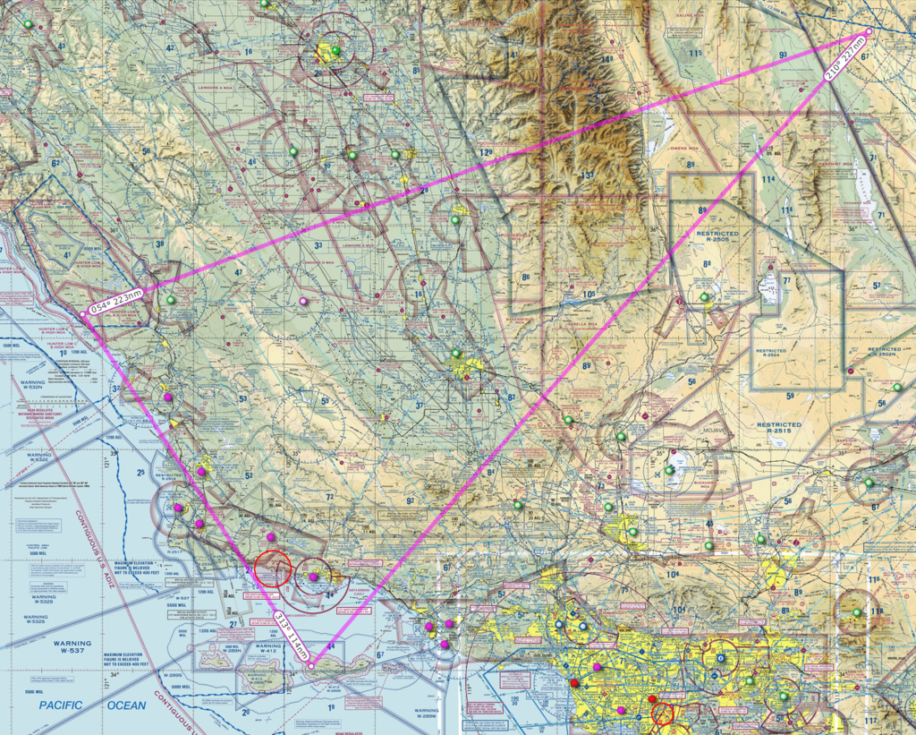
At any rate, I have configured my FBOs, pointed round-robin fashion, and jobs are generated. The next step is to figure out realistic flight plans between the three. This is where I'm stumbling. I don't want to transit restricted areas, and I'm highly concerned about violating FAA regulations. The challenges I'm seeing are that KBTY has restricted areas to the southwest, so I'm going to have to fly around those (or perhaps through the Trona Gap, but threading that needle looks tough) and the Sierra Nevada Mountains lying between 66CA and KBTY (they also potentially come in to play running between KBTY and CA97, I think).
Anyone have any suggestions on a way to lay out a realistic flight plan that gets me between these fields? I've included a Skyvector grab below if it helps. Thanks in advance for any insights/suggestions!
Aircraft:
- JS32
- MU2
- C208
- COL3
- BK17
- PA38 (won't be used for FSE)