Re: Odd requirement on an approach
Posted: Fri May 10, 2013 3:22 pm
Keith,
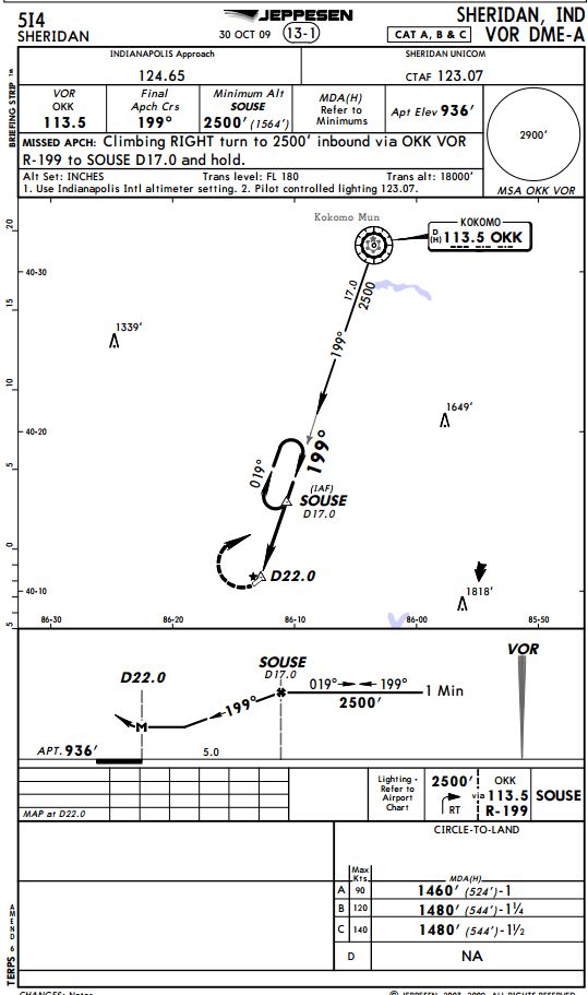
Great point! I still think it's odd that the airport is not in the MSA. Even the AIM suggests that the airport surface should be included. At least that's how I read it. To your point, even when maneuvering from MAP for the missed procedure, you would be below MSA. Therefore the MSA is irrelevant at that point in the procedure.
c. Minimum Safe/Sector Altitudes (MSA) are published for emergency use on IAP charts. For conventional navigation systems, the MSA is normally based on the primary omnidirectional facility on which the IAP is predicated. The MSA depiction on the approach chart contains the facility identifier of the NAVAID used to determine the MSA altitudes. For RNAV approaches, the MSA is based on the runway waypoint (RWY WP) for straight-in approaches, or the airport waypoint (APT WP) for circling approaches. For GPS approaches, the MSA center will be the missed approach waypoint (MAWP). MSAs are expressed in feet above mean sea level and normally have a 25 NM radius; however, this radius may be expanded to 30 NM if necessary to encompass the airport landing surfaces. Ideally, a single sector altitude is established and depicted on the plan view of approach charts; however, when necessary to obtain relief from obstructions, the area may be further sectored and as many as four MSAs established. When established, sectors may be no less than 90° in spread. MSAs provide 1,000 feet clearance over all obstructions but do not necessarily assure acceptable navigation signal coverage.
